Google Maps has been updated to provide a new map detail layer, alerting users of Covid-19 infection trends in the areas they navigate though. In a blog post called Navigate safely with new Covid data in Google Maps, Google says that the new layer will enable users to "make more informed decisions about where to go and what to do".
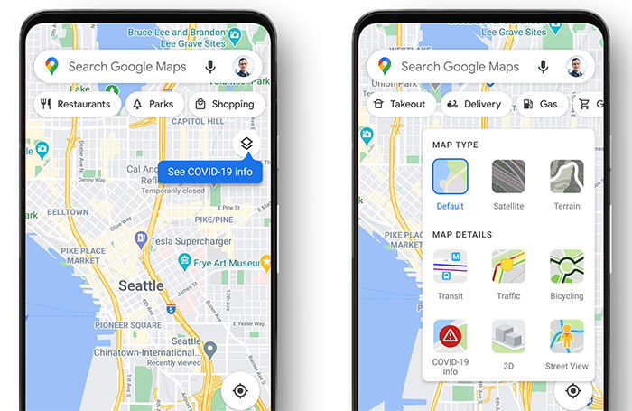
If you are using Google Maps on your mobile you can see the layer choices in the app by clicking the icon to the upper right above the compass - it looks like one square of paper on top of another. Once clicked you are presented with three maps types - default, satellite or terrain - as well as six map detail overlay options. The six overlay options on my Android phone app are; transport, traffic, cycling, 3D, Street View, and the new 'Covid-19 info' overlay option.

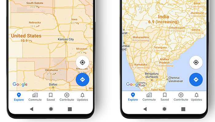
Upon clicking this layer option (it works as a toggle) you will be presented with a seven-day average of new Covid cases per 100,000 people for the area of the map you're looking at. Additionally there is a trend arrow, indicating whether cases are going up or down. Google is also applying a colour coding scheme to help you distinguish the base densities of various areas.
Google says that trending case data is "visible at the country level for all 220 countries and territories that Google Maps supports, along with state or province, county, and city-level data where available". At the present time it is scraping Coivd data from a number of sources such as Johns Hopkins, the New York Times, and Wikipedia which collect their data from the likes of the WHO, government health ministries, along with state and local health agencies and hospitals.

As you can read above, the Covid-19 overlay toggle is available in my Google Maps app, however it isn't showing me any info, colour coding, or trends at the time of writing (even when I checked areas abroad like the USA). Google says, in its blog, posted yesterday, that the Covid layer rolls out this week worldwide, but I guess there is still some background work to be done for it to function for UK dwellers. It might be worth mentioning that I saw no Covid-19 overlay options in Google Maps in my PC browser, only in the mobile app.


